Tangible Interface XR and Urban Design Hands-on
The Tangible Interface XR can be utilized in the processes of urban design and planning. If fostering mutual understanding among people from diverse backgrounds is necessary, this tool and its accompanying methodology are more effective than any existing approach.
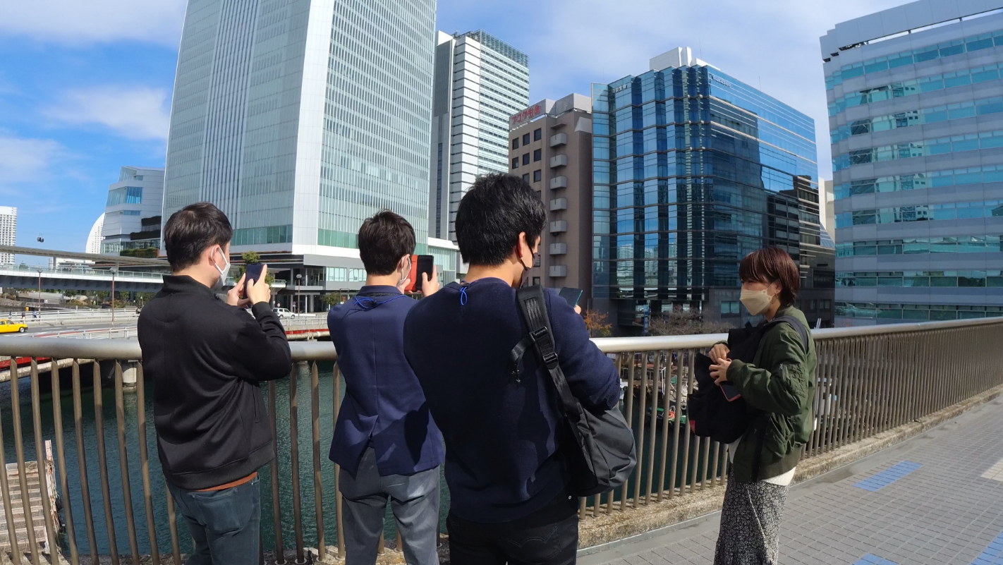
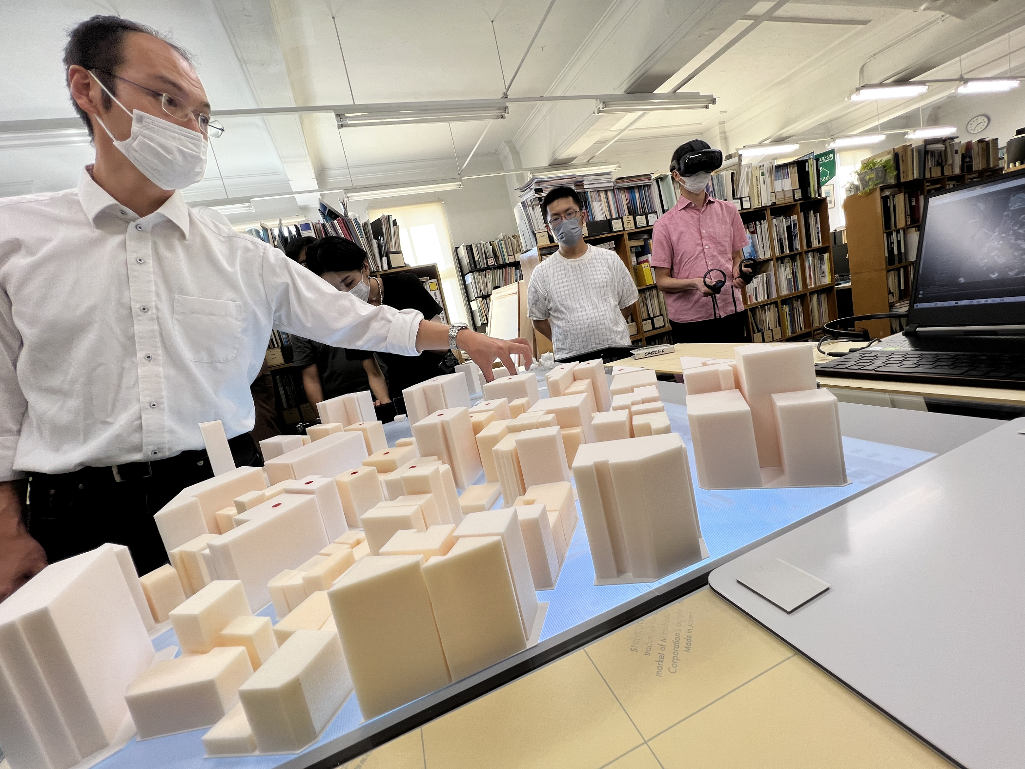
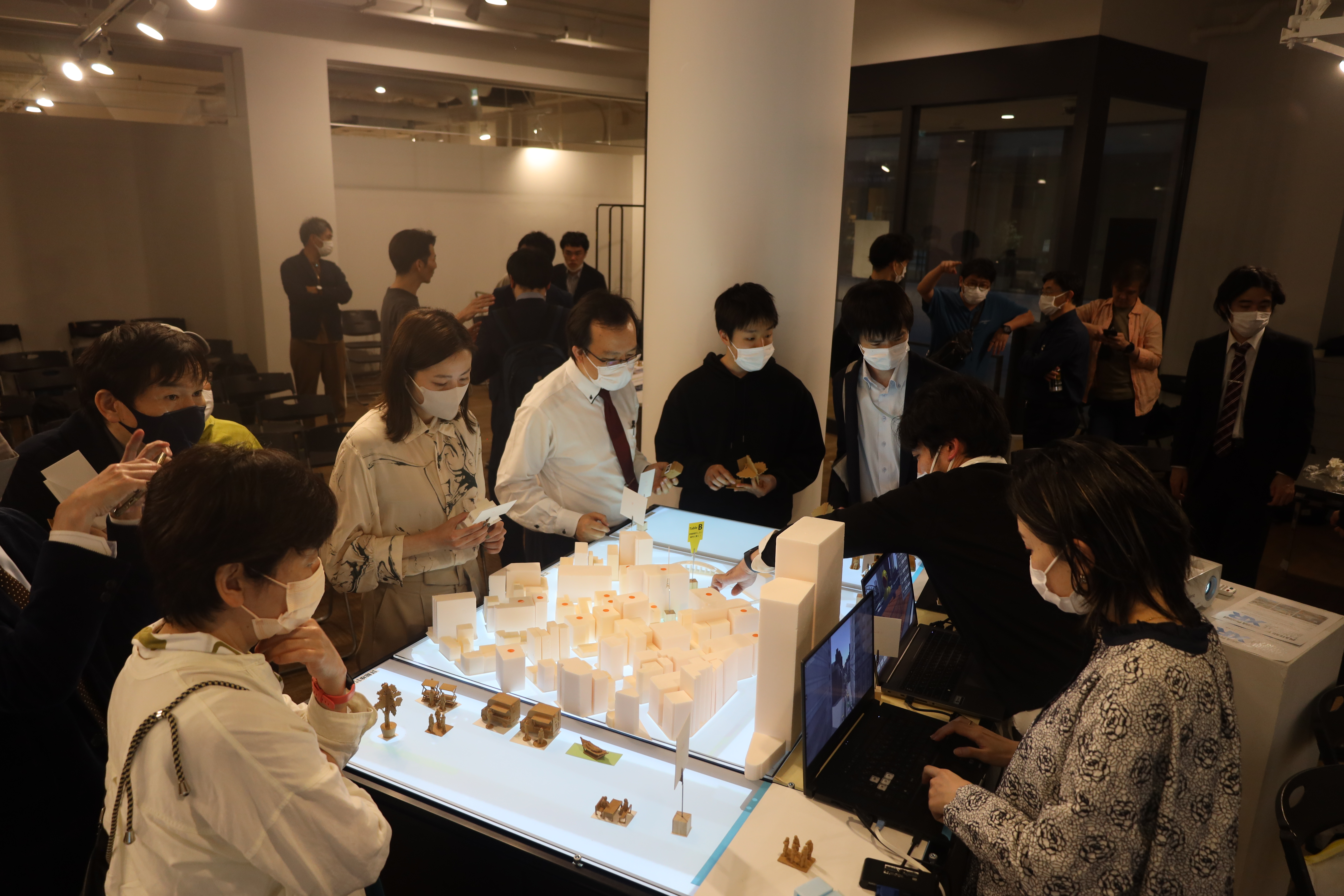
We have developed a workshop methodology called 'Urban Design Hands-on' in conjunction with the Tangible Interface XR. This approach allows for more participatory workshops, engaging a wide range of individuals, from school children to the elderly.
Our Solution in a nut shell
- `Urban Design Hands-on`; it is an innovative workshop methodology that can be implemented in the processes of urban design and urban management.
- You can directly manipulate the landscape within the digital twin using tangible figures for intuitive operations.
- People from different backgrounds collaborate and produce a unified presentation on how to utilize a space in the city.
- It's absolutely the simplest way to design urban spaces, even if you're not an expert.
- Engaging with the Tangible Interface XR is truly enjoyable. Anyone, from school children to the elderly, can interact with it.
How to Use It
Preparing Before use
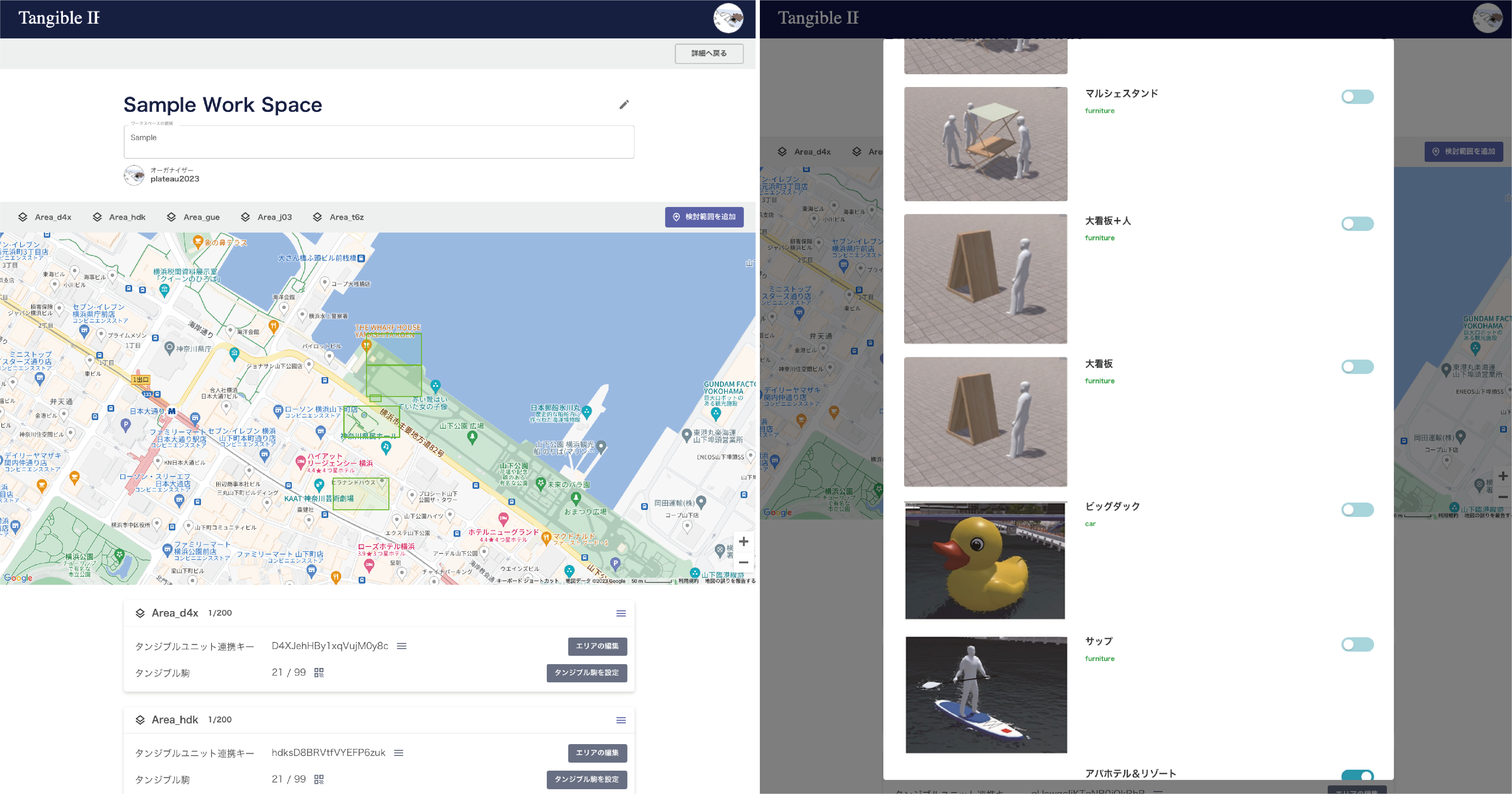
First of all, choose a specific topic for discussion, such as the skyline or cityscape of your city, or how to utilize public spaces. This system requires a Digital Twin and street furniture models, which depend on the selected topic or theme for the discussion. You will need to develop these 3D models and register in our system in advance.
- First,
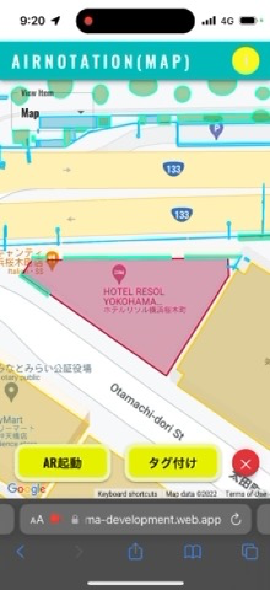
- select the area and scale for each Tangible Unit on a map using the cloud app. You can arrange multiple units to cover the area you want. These can be set to various scales, from a human scale (1/50) to an urban scale (1/400 - 1/1000), offering great flexibility.
- Next,
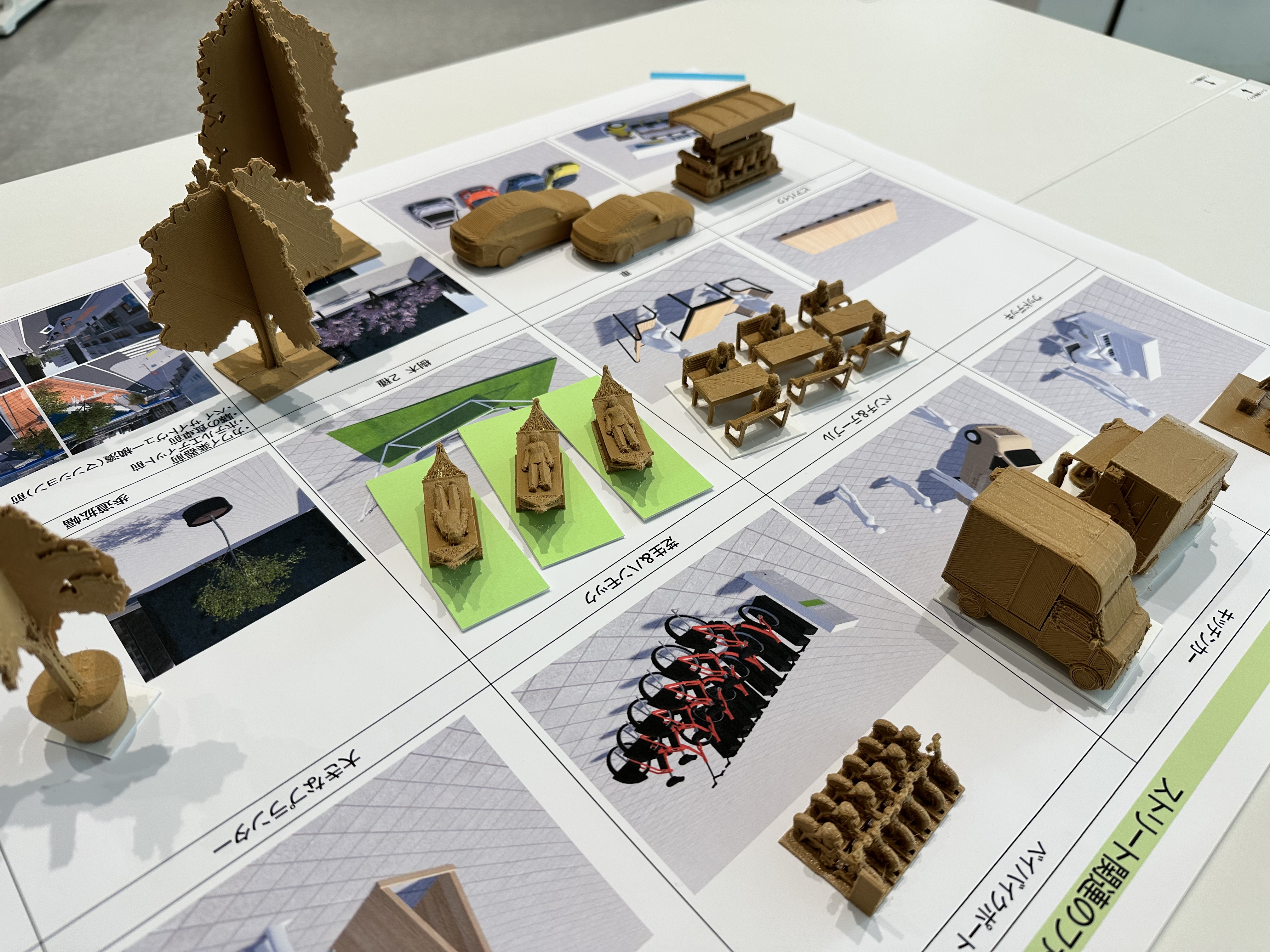
- link the figures you want to use with each unit. You can choose from a variety of figures, such as cars, tables, boats, buildings, and more.
- Finally,
- it's time to use the Tangible Units. Place or move figures on the unit and start envisioning your ideal future city.
Architecture
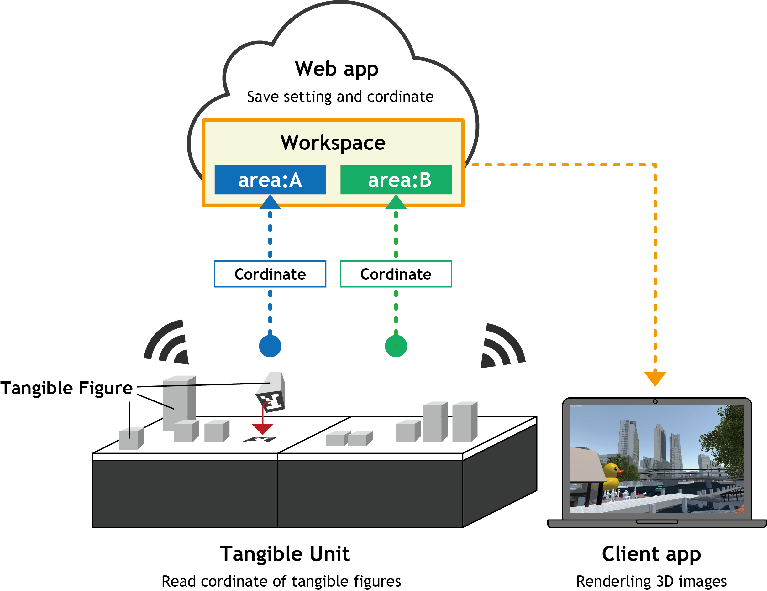
Each Tangible Unit contains its own microcomputer. This computer connects to the internet and sends the coordinate data of figures placed on the table.
Our cloud system is equipped with several APIs. These APIs transmit setting information and map coordinates. Client applications, such as Unity apps or web apps, receive this coordinate data and render 3D images dynamically.
Tangible Unit
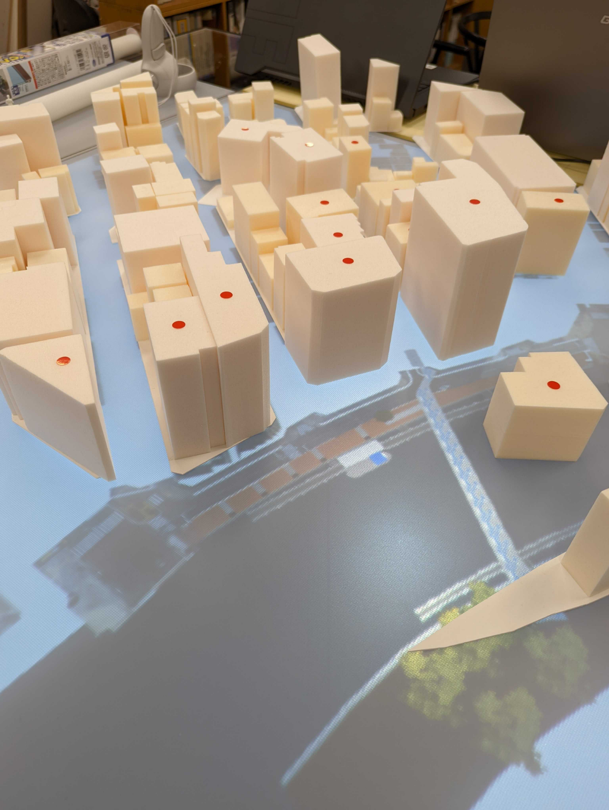
The Tangible Unit features a 23.8-inch LCD capable of displaying digital maps or digital twin images when viewed directly from above.
Our system accommodates the addition of multiple units, allowing them to function either independently or in conjunction with others within the same workspace. This flexibility means our system can adapt to the specific requirements of your workshop design.
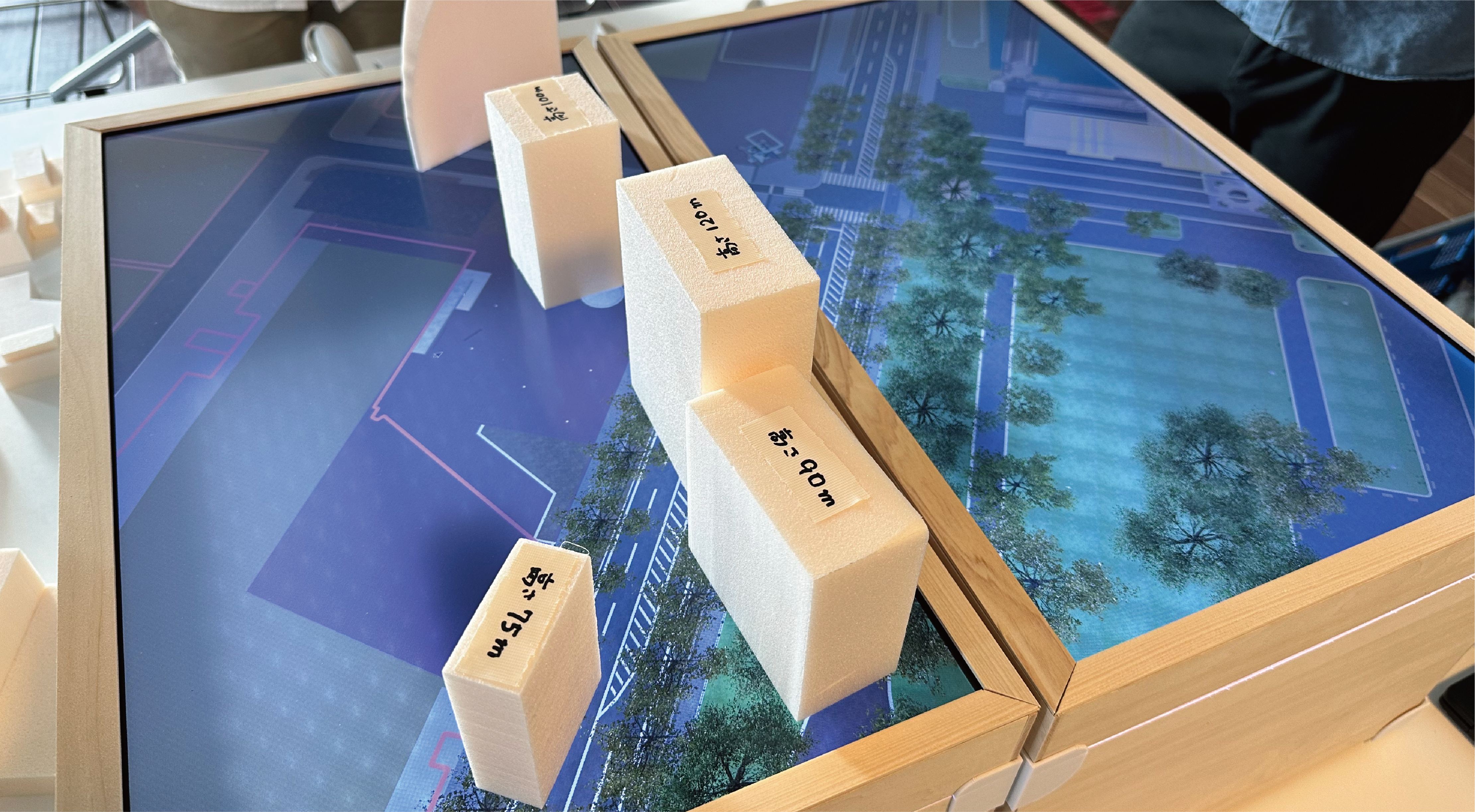
Tangible Figures
Each tangible figure has a 2D marker on its bottom. These markers are used to recognize IDs representing 3D models. The Tangible Unit can read hundreds of markers placed on it simultaneously.
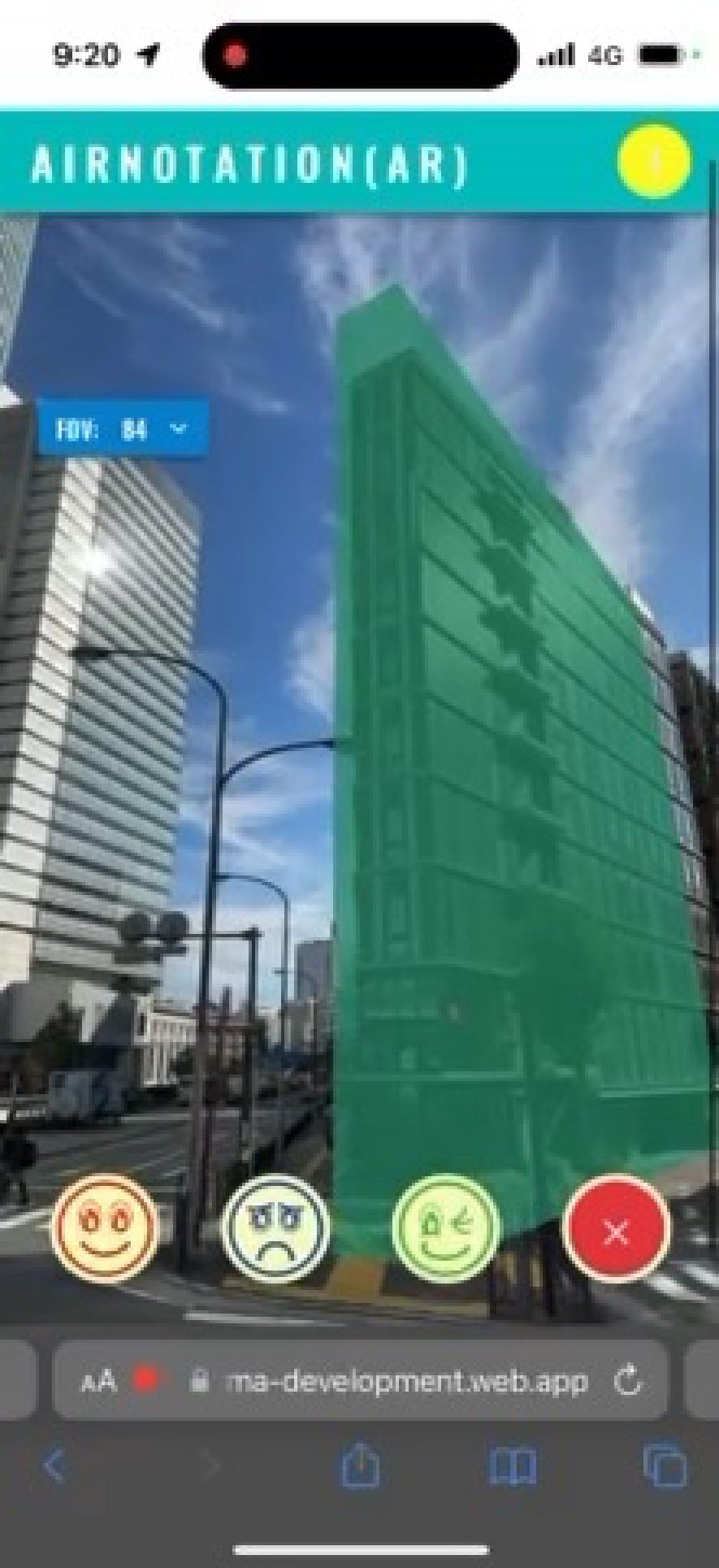
Special markers allow you to use functions like widening sidewalks or removing fences. Additionally, a camera figure is available for use. You can choose from several cameras, each with different positions and lenses.
Web App
The Web App is a core component of our system. Through this app, you can configure and control the entire system. 'Workspaces' is a key concept in our system. This feature links multiple Tangible Units and allows you to set parameters such as scale and map area for each unit. Tangible figures are also integrated and managed through this Web App.
Client App
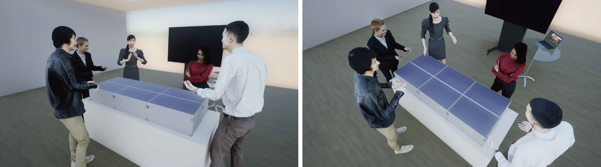
So far, we have developed two client apps. The first one, created with Unity, is capable of rendering high-quality 3D images and functions as a VR host. You can explore the cityscape you designed using Tangible Units with a Head Mount Display.
The second is a web-based 3D viewer that operates within a web browser. It has been implemented as a feature within our Web App.
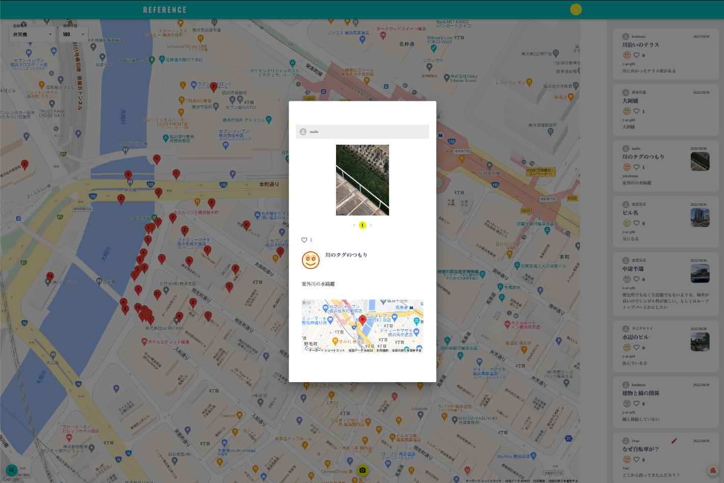
Each client app features the ability to capture 3D rendered images along with the coordinate data of tangible figures and any added comments. These captured images can be uploaded and replayed in the app at any time.
Tangible Interface XR to your city
If you are interested in our solution, please don't hesitate to contact us. We are ready to consult with you on how to adapt our system to meet the specific needs of your city.
Of course, it's okay. Our system is adaptable to any project, from small spaces within a building to the reconstruction of an entire town.
The Digital Twin Project by Japanese Government
The Japan Ministry of Land, Infrastructure, Transport, and Tourism (MLIT) has initiated a project to build a 3D city model infrastructure, known as Project PLATEAU.
Our solution, 'Tangible Interface XR and Urban Design Hands-on', has been selected as a leading project for Project PLATEAU. We are actively collaborating with the Japanese Government to advance Project PLATEAU and to promote the use of digital twins in the fields of urban design and management in Japan.